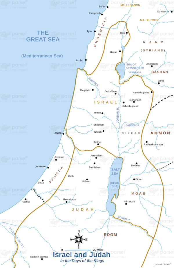
Israel and Judah
19,00 €
- Description
Description
The stock image shows the territories of Israel and Judah during the time of the divided monarchy in ancient Israel. The northern kingdom of Israel, consisting of ten tribes, is shown in green, while the southern kingdom of Judah, consisting of two tribes (Judah and Benjamin), is shown in yellow. The map also shows the major cities in each kingdom, such as Samaria in Israel and Jerusalem in Judah.
The two kingdoms were divided after the reign of King Solomon, who ruled a united Israel. The northern kingdom was established in 922 BCE after the death of Solomon, and the southern kingdom of Judah was established in 926 BCE. The two kingdoms existed separately until 722 BCE when the Assyrian Empire conquered Israel, and the northern kingdom was destroyed.
The map provides a clear visualization of the division of ancient Israel into two kingdoms and their respective territories, which were often at odds with each other politically and religiously. It also shows the strategic importance of major cities like Jerusalem, which served as the capital of Judah and the center of Jewish religious life and worship.


