Ancient Empires
17,00 €
- Description
Description
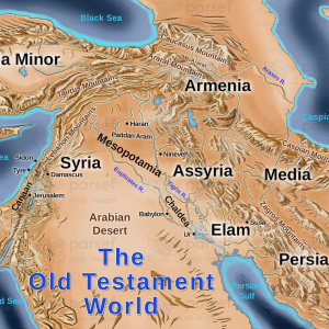
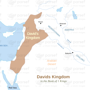
The stock image depicts a map of the ancient empires that existed during biblical times in the Near East. The map is set against a neutral beige background, with black borders and white font to label the various regions and empires.
The map shows the geographical boundaries of the major empires that dominated the region during this period, including the Egyptian, Assyrian, Babylonian, and Persian empires. These empires were known for their wealth, power, and military might, and played a significant role in shaping the political and cultural landscape of the Near East.
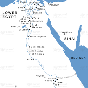
Various cities and regions are labeled on the map, such as Thebes, Memphis, Nineveh, Babylon, and Susa. The image also features illustrations of notable landmarks and structures, such as the pyramids at Giza and the Ishtar Gate of Babylon.
Additionally, the map highlights the interactions and conflicts between these empires, as they vied for control of land, resources, and power. The image also underscores the role that these empires played in shaping the history and culture of the Near East, including their impact on the Israelites and other peoples in the region.
Overall, this stock image provides a visual representation of the major empires that existed during biblical times in the Near East, highlighting their geographical boundaries, the cities and regions they controlled, and their interactions and conflicts with each other. It serves as a reminder of the complex political and cultural landscape of the region during this pivotal period in human history.


