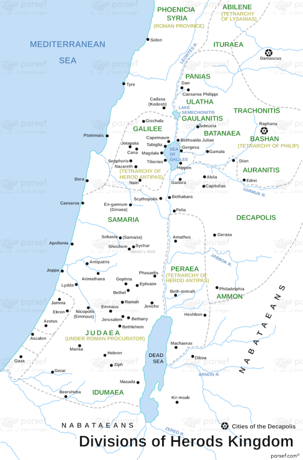
Divisions of Herods Kingdom
17,00 €
- Description
Description
The stock image depicts the territorial divisions of the Kingdom of Herod the Great during his reign in ancient Judea in the 1st century BC. The map shows the main areas and regions of Herod’s kingdom, including Galilee, Perea, Judea, and Idumea, along with major cities such as Jerusalem, Joppa, and Caesarea.
The map also shows the borders of neighboring regions such as Samaria, Phoenicia, and Syria.
The map can be used to illustrate the extent of Herod’s influence and power in the region and the geopolitical context of the New Testament era.


