The Kingdom of David and Solomon
$20.00
- Description
Description
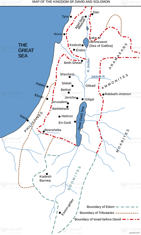
The stock image displays the Kingdom of David and Solomon, which existed in ancient Israel from approximately 1000 BC to 930 BC. The map shows the borders of the kingdom, which stretched from the Euphrates River in the north to the Red Sea in the south, and from the Mediterranean Sea in the west to the Arabian Desert in the east.
The major cities of the kingdom, such as Jerusalem, Hebron, and Bethlehem, are also shown on the map. Additionally, the location of important landmarks, including the Temple Mount in Jerusalem, the Gihon Spring, and the Pool of Siloam, are highlighted.
The map provides insight into the extent and power of the Kingdom of David and Solomon during its peak, as well as its strategic location as a crossroads between Asia, Africa, and Europe.


