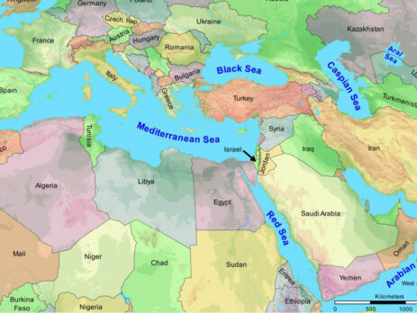
Visualizing Scripture: Creating Digital Bible Maps for Deeper Understanding
The Bible, with its rich tapestry of historical events and geographical settings, offers readers a glimpse into the ancient world and the lives of its people. However, comprehending the complex journeys, migrations, and locations described in the sacred texts can sometimes be challenging. In the digital age, cartography has become a powerful tool for visualizing and exploring the biblical narrative, allowing us to create digital Bible maps that offer deeper insights and understanding of the scriptures. In this article, we will explore the significance of visualizing Scripture through digital maps and how they can enhance our comprehension of the Bible.
A Visual Journey through the Bible
Reading about the journeys of the Israelites through the wilderness, the travels of the apostles during the early Christian era, or the locations of major biblical events can be enhanced through visual representation. Digital Bible maps provide a unique opportunity to trace these journeys on an interactive map, enabling readers to visualize the distances, routes, and geographical context of the biblical narrative.
Understanding the Spatial Context
The geographical setting of the Bible plays a crucial role in understanding the context of events and the interactions of characters in the biblical accounts. By creating digital Bible maps, readers can grasp the spatial relationships between locations, comprehend the significance of particular regions, and discern the impact of geography on the stories unfolding in the scriptures.
Bridging the Gap of Time and Culture
The Bible was written in a vastly different time and culture, and some locations and names may be unfamiliar to modern readers. Digital Bible maps act as a bridge, connecting the ancient world with the contemporary one. By overlaying modern maps with biblical locations, readers can relate to the events in the Bible more easily, fostering a deeper appreciation for the cultural and historical contexts of the sacred texts.
Unveiling Symbolism and Patterns
The visual representation of biblical events through digital maps can unveil symbolism, patterns, and connections that may be less apparent in a traditional textual reading. By seeing the distribution of events across regions or observing the recurring patterns of journeys, readers can gain new insights into the underlying themes and messages present in the scriptures.
Encouraging Interactive Learning
Digital Bible maps encourage interactive learning and exploration. Users can interact with the map, zoom in and out, click on locations for additional information, and engage with multimedia elements like images, videos, or audio. This interactivity creates an immersive learning experience, inviting readers to dive deeper into the stories and absorb the historical and geographical context.
Enhancing Bible Study and Teaching
For Bible students, teachers, and scholars, digital Bible maps offer valuable tools for enhancing study and teaching. These maps can be used as visual aids in sermons, lectures, or presentations, providing a clear and compelling way to communicate complex biblical journeys and events. They can also be incorporated into educational materials, bringing the Bible to life in classrooms and study groups.
Facilitating Cross-Referencing and Research
Digital Bible maps can facilitate cross-referencing and research. By integrating multiple data sources, users can compare different maps, explore different interpretations of geographical details, and delve into academic studies related to biblical geography. This enriches the learning experience and encourages a more thorough understanding of the scriptures.
Fostering Personal Connection
Engaging with digital Bible maps on a personal level can foster a deeper connection with the biblical narrative. As readers navigate the routes taken by biblical characters or visualize the locations of pivotal events, they can develop a sense of proximity to the stories, enhancing their own spiritual journey and understanding of the faith.
Visualizing Scripture through digital Bible maps is a powerful means of enhancing our understanding and connection with the sacred texts. By creating visual representations of biblical events, journeys, and locations, readers can grasp the spatial context, bridge the gap of time and culture, and unveil symbolism and patterns in the scriptures. Digital Bible maps encourage interactive learning, enhance Bible study and teaching, and facilitate cross-referencing and research. They offer a transformative way to engage with the Bible, unlocking deeper insights and forging a meaningful connection with the ancient narratives that continue to inspire and guide millions of hearts and minds.

