Herod the Great’s Kingdom
18,00 €
- Description
Description
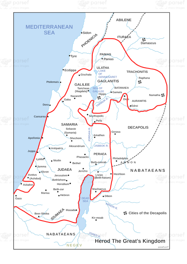
The stock image depicts the extent of the territories ruled by King Herod the Great during his reign from 37-4 BC. The map shows the regions of Judea, Galilee, Samaria, and Idumea, as well as the cities and towns within those regions, including Jerusalem, Bethlehem, Nazareth, Caesarea, and Jericho.
The map also includes important landmarks such as the Jordan River, the Dead Sea, and the Mediterranean Sea.
The map is useful for illustrating the political and territorial landscape during the time of Jesus and the early Roman Empire, and for contextualizing the events of the New Testament.


