Asia Minor
18,00 €
- Description
Description
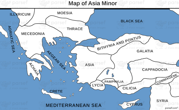
The stock image is a detailed illustration of the vast peninsula located in western Asia, also known as Anatolia. The map is designed with a parchment-style background, featuring intricate illustrations of the region’s geography, cities, and important landmarks.
The map shows Asia Minor as a peninsula that extends westward from the Middle East into the Aegean Sea, bordered by the Black Sea to the north and the Mediterranean Sea to the south. The various regions of Asia Minor, including Bithynia, Galatia, Cappadocia, and Lydia, are depicted with different colors and shading, helping to distinguish them from one another.
The map also features important cities, such as Troy, Smyrna, and Ephesus, which were all significant cultural, economic, and political centers throughout history. Each city is marked with a symbol and bold lettering, making them easily identifiable on the map.
Several mountain ranges and rivers are also illustrated on the map, including the Taurus Mountains, the Halys River, and the Meander River. These natural features are important for understanding the geography of the region and the historical significance of different areas.
In addition, the map provides a legend that explains the various symbols and colors used to represent different features of Asia Minor, such as roads, ports, and other important landmarks.
Overall, the stock image is a valuable resource for students, historians, and anyone interested in the geography and history of this important region of the world. The detailed illustrations and clear labeling make it easy to understand the geography and significance of different areas within Asia Minor.


