Edomite Territory
17,00 €
- Description
Description
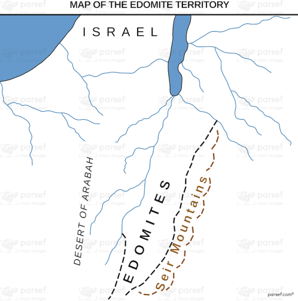
The stock image depicts the ancient territory of the Edomites during biblical times. The map is colored in muted earth tones, with jagged lines indicating the borders of the region. The Edomite Territory is located in the southern part of the Levant, south of the Dead Sea and the Jordan River. The map shows the rugged terrain of the area, with hills and mountains dominating the landscape.
The map includes important cities and landmarks of the Edomite Territory, such as Petra, the ancient city carved into the red rock, and Mount Seir, the rugged mountain range that was home to the Edomites. The cities and towns are represented by small icons, while the topography is illustrated with contour lines.
In the biblical era, the Edomites were a group of people who lived in this territory and were descendants of Esau, the brother of Jacob. They were known for their skill as metalworkers and for their close ties to the neighboring kingdom of Judah. The map provides context for the biblical stories that mention the Edomites and helps to visualize the region where they lived.

