II Kings Captivity of 10 Tribes
17,00 €
- Description
Description
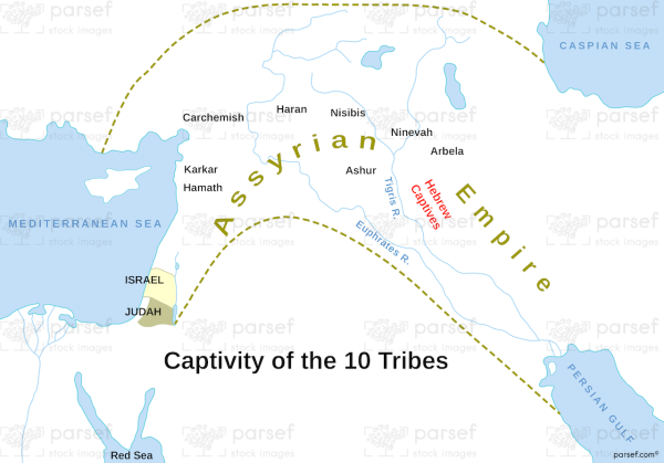
The stock image is a map of the captivity of the ten tribes of Israel as recorded in the book of 2 Kings in the Bible. The map shows the location of the ten tribes and the route they took as they were exiled from their land by the Assyrian Empire.
The ten tribes were taken captive in 722 BC, and their exile marked the end of the Northern Kingdom of Israel. The map also includes other locations mentioned in the book of 2 Kings, such as the cities of Samaria and Damascus, as well as the River Jordan.
The image provides a visual representation of the events described in the Bible, making it a valuable resource for those interested in studying the history and geography of ancient Israel.


