Israel in the Old Testament
$20.00
- Description
Description
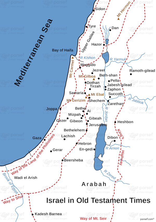
The stock image depicts the geographic region that was known as Israel during the time of the Old Testament. The map is rendered in a muted color scheme, with major cities and landmarks marked in black.
The map shows the borders of ancient Israel during the time of the Old Testament, which extended from the Mediterranean Sea in the west to the Jordan River in the east. The region is also bordered by the Sinai Peninsula in the south and the mountains of Lebanon in the north.
The map highlights important ancient cities in Israel, such as Jerusalem, Hebron, Bethlehem, and Jericho. These cities were significant in biblical history, as they were centers of religion, culture, and commerce.
The map also shows important landmarks in the region, such as the Dead Sea, the Sea of Galilee, and the Jordan River, which were all important water sources for ancient societies. The map also features important mountain ranges, such as the Judean Mountains and the Carmel Range, which were important for agriculture and trade.
Other important sites in the region include the ancient city of Samaria, which was the capital of the northern kingdom of Israel, and the city of Beersheba, which was an important center for trade and commerce.
Overall, the stock image provides a detailed and visually engaging representation of the geographic region that was central to the history and culture of the ancient Israelites. It is a useful resource for historians, educators, and anyone interested in the rich history of the region.


