Israel Under Rehoboam
17,00 €
- Description
Description
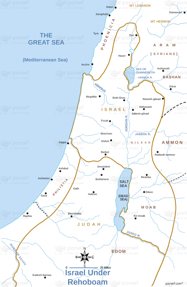
The stock image portrays the geopolitical boundaries and important locations during the reign of Rehoboam, son of King Solomon, in the ancient Kingdom of Israel.
The map highlights the borders of the divided kingdom, with Rehoboam ruling over the southern kingdom of Judah, and Jeroboam ruling over the northern kingdom of Israel. The map also includes major cities and landmarks such as Jerusalem, Bethlehem, Hebron, and Shechem. Additionally, the map indicates important battle sites, such as the conflict between Rehoboam and the Egyptian Pharaoh Shishak.
Overall, the map provides a visual representation of the political and territorial landscape of Israel during this period of its history.


