Israel’s Natural Divisions
$20.00
- Description
Description
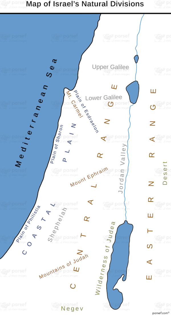
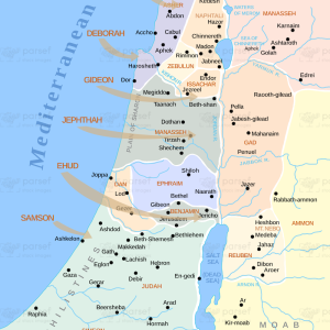
The stock image depicts the various physical features of the land of Israel. The map is color-coded and labeled with the names of each region, making it easy to identify them. The map shows the four main natural divisions of Israel: the coastal plain, the hill country, the Jordan Rift Valley, and the Negev Desert.
The coastal plain is a narrow strip of land along the Mediterranean Sea, while the hill country consists of the central highlands of Israel. The Jordan Rift Valley is a geological fault that runs north-south through the country, and the Negev Desert is a large, arid region in the south. The map also includes major bodies of water such as the Sea of Galilee, the Dead Sea, and the Mediterranean Sea.
This map is useful for anyone studying the geography of Israel or for travelers exploring the land.

