Land of Ancient Egypt
$20.00
- Description
Description
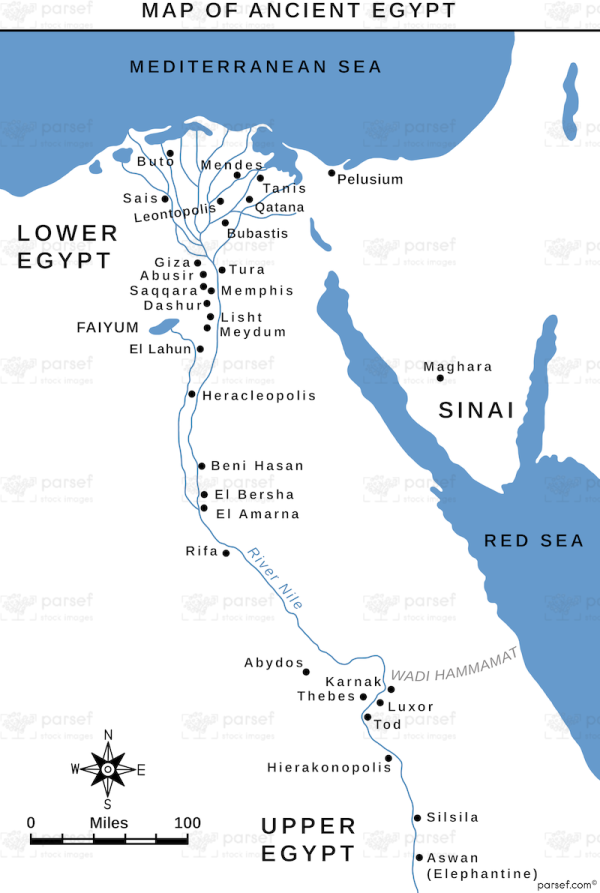
The stock image shows the Land of Ancient Egypt, a vast and prosperous empire that flourished in Northeast Africa for thousands of years. The map displays the Nile River, the lifeblood of the empire, flowing through the heart of the region and nourishing the fertile land on either side.
The map highlights the key cities of Ancient Egypt, such as Memphis, Thebes, and Alexandria, as well as the various regions that made up the empire, including Upper Egypt and Lower Egypt. Other notable features on the map include the Great Pyramids of Giza, the Sphinx, and the Valley of the Kings, where many pharaohs and other powerful figures were buried.
The map provides a visual representation of the geography of Ancient Egypt and allows viewers to better understand the empire’s significance and influence on world history.


