Map Ancient Near East
$20.00
- Description
Description
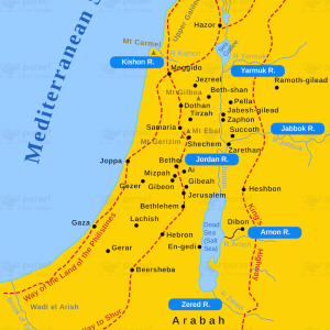
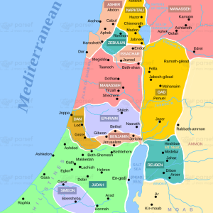
The stock image depicts the region of the world that extends from the eastern Mediterranean Sea to the Persian Gulf, covering parts of modern-day Egypt, Israel, Jordan, Lebanon, Syria, Iraq, Iran, and Turkey. The map highlights the major cities, rivers, and other geographic features of the region, including the Nile River, the Tigris and Euphrates Rivers, the Dead Sea, and the Red Sea.
The map also shows the ancient empires that ruled the region throughout history, including the Egyptian, Assyrian, Babylonian, Persian, and Greek empires.
The map provides a comprehensive view of the ancient world and its significant cultural, religious, and political developments that shaped human history.