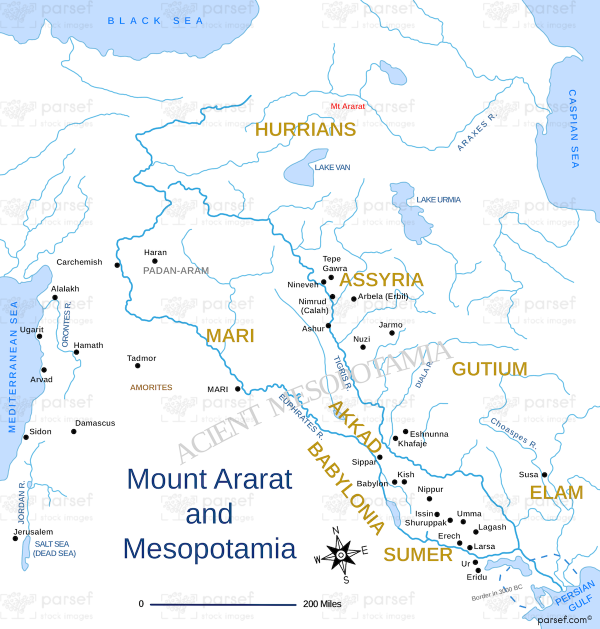
Mount Ararat and Mesopotamia
17,00 €
- Description
Description
The stock image depicts the region that spans across modern-day Turkey, Armenia, and Iraq. The map highlights Mount Ararat, which is located in eastern Turkey and is believed to be the place where Noah’s Ark landed after the Great Flood, according to the biblical account.
The map also covers the fertile plain of Mesopotamia, which is often referred to as the cradle of civilization as it is where some of the earliest civilizations such as Sumer, Akkad, Assyria, and Babylon developed. The Tigris and Euphrates rivers, which flow through the region, are also highlighted on the map.
The map provides a visual representation of the geographical and historical significance of the region, which has been inhabited by various ancient civilizations and empires throughout history.


