Samaria and Central Israel
$20.00
- Description
Description
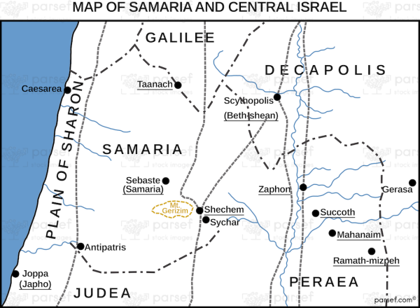
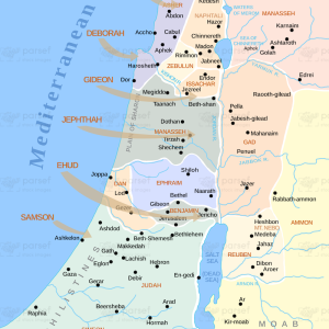
The stock image depicts the region of Samaria and Central Israel during biblical times. The map highlights the ancient city of Samaria, the capital of the Kingdom of Israel, which was established by King Omri in the 9th century BC. The city is situated on a hilltop, surrounded by a fertile valley, and was strategically located on the trade route between Egypt and Mesopotamia.
The map also shows the central region of Israel, including the cities of Jerusalem, Bethlehem, and Jericho. Jerusalem, the holy city and capital of the Kingdom of Judah, was a major religious and cultural center, and the site of the Temple, the most important Jewish holy site. Bethlehem was the birthplace of King David and later Jesus Christ, while Jericho was a key city in the Israelite conquest of Canaan and one of the oldest continuously inhabited cities in the world.
The map further displays the geography of the region, with the Mediterranean Sea to the west, the Jordan River to the east, and the hills and valleys in between. The area was known for its agricultural productivity, with olive trees, vineyards, and wheat fields covering the hillsides. The map also features the tribal regions of Ephraim and Manasseh, two of the twelve tribes of Israel.
Overall, this map provides a visual representation of the important biblical sites and geography of Samaria and Central Israel during ancient times.

