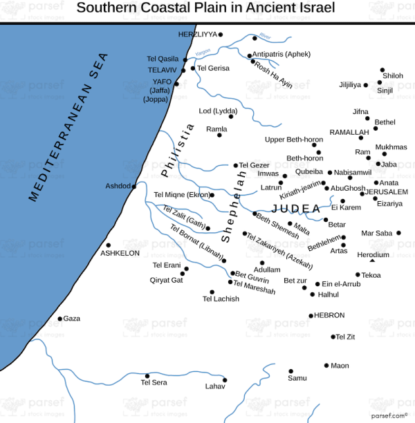
Southern Coastal Plain in Ancient Israel
18,00 €
- Description
Description
This stock image depicts the Southern Coastal Plain in Ancient Israel during biblical times. The map highlights the geographical features of the region, including the Mediterranean Sea, the Shephelah (the lowland hills), and the coastal plain. The region was known for its fertile soil and Mediterranean climate, making it an important agricultural center in the ancient world.
The map also features key cities and towns in the region, such as Ashkelon, Gaza, and Ashdod, which were major Philistine cities and played important roles in the conflicts between the Israelites and the Philistines. Other significant locations in the region include Joppa, which was an important port city, and Lachish, which was a major Canaanite stronghold.
Additionally, the map highlights the major trade routes that crossed through the region, including the Via Maris, which connected Egypt and Syria, and the coastal road, which provided access to the ports and cities along the coast. These trade routes played a significant role in the economic and cultural exchanges between ancient civilizations in the Near East.