Syria at its Height
18,00 €
- Description
Description
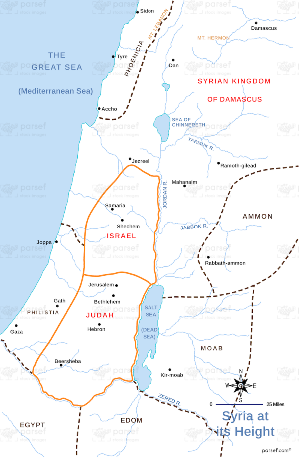
The stock image portrays the political boundaries and major cities of ancient Syria during its peak period. The map shows the region stretching from the Mediterranean Sea to the Euphrates River and covers modern-day Syria, Lebanon, Israel, and Jordan.
The cities of Damascus, Homs, Aleppo, and Palmyra are prominently featured, along with other smaller settlements. The map also indicates the location of important trade routes, such as the Silk Road and the Mediterranean trade route.
The ancient civilization of Syria was known for its advancements in agriculture, trade, and art, and this map provides a glimpse into its historical and cultural significance.


