Moses and the Exodus Topo
18,00 €
- Description
Description
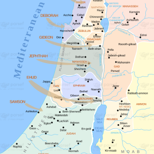
The stock image depicts a topographical map of the region through which Moses and the Israelites traveled during the Exodus, as described in the biblical narrative. The map is set against a neutral beige background, with black borders and white font to label the various regions and landmarks.
The map shows the topography of the land, with varying shades of brown and green indicating changes in elevation and vegetation. The region is divided into several areas, including the Nile Delta, the Sinai Peninsula, and the Negev Desert.
Various cities and regions are labeled on the map, such as Memphis, Goshen, the Red Sea, and Mount Sinai. The Nile River is prominently displayed, running from south to north and providing a crucial source of water and resources for the Israelites during their journey.
The image also features illustrations of notable landmarks and structures, including the pyramids at Giza and the Tabernacle that the Israelites constructed during their time in the wilderness.
Additionally, the map highlights the challenges that Moses and the Israelites faced during their journey, including harsh desert conditions and encounters with hostile armies. The Red Sea is shown as a formidable obstacle that the Israelites crossed with the help of divine intervention.
Overall, this stock image provides a visual representation of the region through which Moses and the Israelites traveled during the Exodus, highlighting the topography and challenges of the land that the Israelites faced as they journeyed towards the Promised Land.


