Asia in the New Testament
17,00 €
- Description
Description
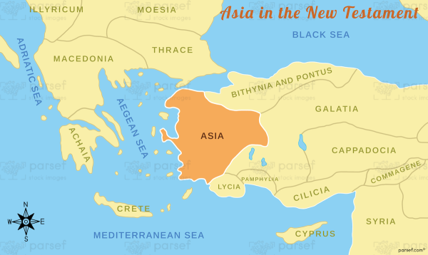
The stock image depicts the ancient region of Asia as it was known during the time of the New Testament in the first century CE. The map is rendered in a muted color scheme, with the different regions and territories marked in different colors for clarity.
The map shows the region of Asia, which includes modern-day Turkey and parts of Greece, Iran, and Syria. It highlights the different cities and settlements that were located in the region, including the important cities of Ephesus, Colossae, and Laodicea.
The map also shows the different routes and trade networks that existed during this time, including the important trade route known as the Via Egnatia, which connected Rome to the eastern parts of the Roman Empire.
The region of Asia played an important role in the spread of early Christianity, and the map highlights the different regions where Christian communities were established, such as Galatia, Lydia, and Phrygia. It also shows the various journeys and missionary activities of the apostles, including Paul and Peter, who traveled throughout the region to spread the gospel.
Overall, the stock image provides a detailed and visually engaging representation of the ancient region of Asia during the time of the New Testament, and is a useful resource for historians, educators, and anyone interested in the history and culture of the early Christian church.


