Assyrian Empire
18,00 €
- Description
Description
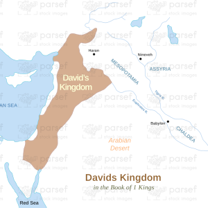
The stock image depicts the extent and territory of the ancient Assyrian Empire, which was a powerful and influential kingdom in the Near East during the first millennium BCE. The map is rendered in a muted color scheme, with the territories of the Assyrian Empire marked in a distinct color.
The map shows the region of the Near East where the Assyrian Empire was centered, including modern-day Iraq, Iran, and parts of Syria and Turkey. It highlights the major cities and settlements that were part of the empire, such as Ashur, Nineveh, and Babylon.
The map also shows the extent of the Assyrian Empire at its height, which spanned from the Mediterranean Sea in the west to the Persian Gulf in the east, and from the Caucasus Mountains in the north to Egypt in the south.
The map highlights the important routes and roads that were used for trade and military campaigns during the time of the Assyrian Empire, such as the Tigris and Euphrates rivers, and the King’s Highway.
Overall, the stock image provides a detailed and visually engaging representation of the extent and territory of the ancient Assyrian Empire, and is a useful resource for historians, educators, and anyone interested in the rich history of the Near East during the first millennium BCE.