Decapolis and its Cities – Basic Map (High Res. Download)
$20.00
- Description
Description
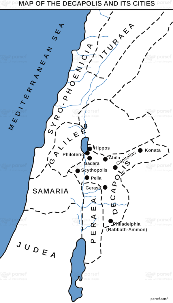
The stock image depicts the region of Decapolis and its cities during ancient times. The map is designed to provide a basic visual representation of the territory, and includes the main cities of the region as well as the surrounding topography.
The region of Decapolis was located in the eastern part of the Roman Empire, to the east of the Sea of Galilee and the Jordan River. The map shows the rugged terrain of the area, with hills and valleys dominating the landscape. The cities of the region are represented by small icons, and are scattered throughout the map in a relatively even distribution.
The map includes the main cities of Decapolis, such as Damascus, Scythopolis, Gadara, and Pella. These cities were known for their cultural and economic significance, and were centers of trade, agriculture, and industry. The cities are represented by small icons that indicate their relative size and importance.
The topography of the map is illustrated with contour lines, which provide a sense of the elevations and slopes of the terrain. The map also includes important landmarks and features of the region, such as the Jordan River and the Dead Sea.
Overall, the map provides a basic understanding of the layout and geography of the region of Decapolis during ancient times. It helps to contextualize the historical and cultural significance of the cities and landmarks of the region, and provides a starting point for further exploration and study.


