Ezra Persian Empire Sixth Century Bc
18,00 €
- Description
Description
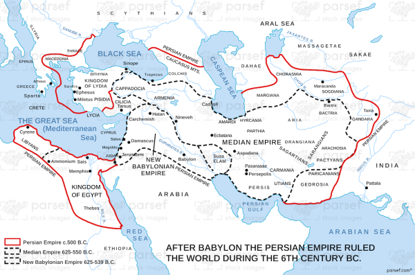
The stock image depicts the Persian Empire during the sixth century BC, when the empire was at the height of its power and influence. The map shows the vast extent of the Persian Empire, including modern-day Iran, Iraq, parts of Central Asia, the Caucasus, and the eastern Mediterranean.
The major cities of the Persian Empire are marked on the map, including the capital city of Persepolis.
The map also includes important trade routes, such as the Silk Road, that helped to connect the Persian Empire to other regions of the world.
This map is useful for historians and scholars studying the Persian Empire and its role in shaping ancient history.

