Fertile Crescent
$20.00
- Description
Description
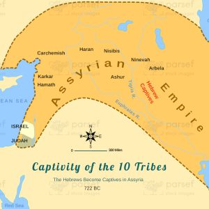
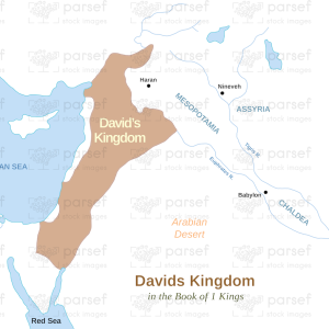
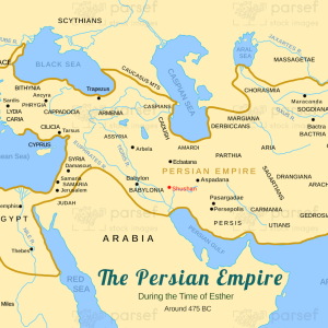
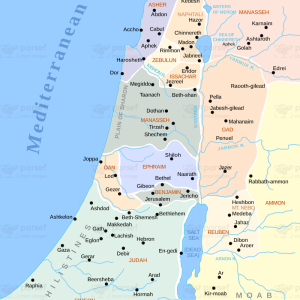
The stock image depicts the geographic region in the Middle East that is often referred to as the “cradle of civilization” due to its importance in the development of early human societies. The map is rendered in a muted color scheme, with major cities and landmarks marked in black.
The map shows the region known as the Fertile Crescent, which stretches from the eastern Mediterranean coast through modern-day Iraq and into Iran. The crescent-shaped region is named for its fertile soil and is bordered by the Tigris and Euphrates rivers, which have been essential to the development of agriculture in the region.
The map highlights important ancient cities in the Fertile Crescent, including Damascus, Jerusalem, Babylon, and Ur, which were centers of culture, trade, and religion in ancient times. The ancient city of Babylon is marked on the map, along with the Hanging Gardens, one of the Seven Wonders of the Ancient World.
The map also features important landmarks from the time of early human civilization, such as the ancient ruins of Persepolis in Iran, the Ziggurat of Ur in Iraq, and the ancient city of Palmyra in Syria.
The Fertile Crescent is also marked by important mountain ranges, including the Taurus Mountains in Turkey and the Zagros Mountains in Iran, which have been crucial to the development of human societies by providing natural resources such as minerals and water.
Overall, the stock image provides a detailed and visually engaging representation of the geographic region that has played an important role in human history. It is a useful resource for historians, educators, and anyone interested in the rich history of the Middle East.


