Galilee in the Time of Jesus
18,00 €
- Description
Description
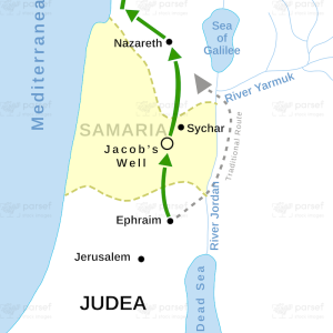
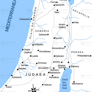
The stock image depicts the region of Galilee during the first century CE, which was the time period in which Jesus of Nazareth lived and taught. The map is rendered in a muted color scheme, with the region of Galilee marked in black.
The map shows the location of Galilee in modern-day northern Israel, and highlights important ancient cities that were part of the region, such as Nazareth, Capernaum, and Tiberias. It also shows important landmarks in the region, such as the Sea of Galilee, which was an important source of water and fish for the people of the region.
Other important sites in the region include the mountains of the Galilee, which were a major center of agriculture and commerce, and the Jezreel Valley, which was an important crossroads for trade and transportation.
The map also includes important routes and roads that were used for travel and commerce during the time of Jesus, such as the Via Maris and the King’s Highway.
Overall, the stock image provides a detailed and visually engaging representation of the region in which Jesus of Nazareth lived and taught. It is a useful resource for historians, educators, and anyone interested in the rich history of the region and its significance in the development of Christianity.