Israel Maccabees
18,00 €
- Description
Description
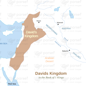
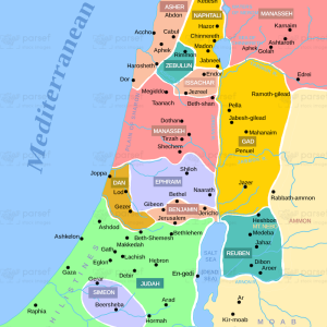
The stock image depicts the geographical boundaries of the Kingdom of Israel during the time of the Maccabean Revolt. The map features key locations such as Jerusalem, Bethlehem, Hebron, Samaria, Galilee, and the Jordan River.
The territories of the various kingdoms and empires that ruled over Israel during this time, such as the Seleucid Empire, the Ptolemaic Kingdom, and the Roman Empire, are also indicated.
The map illustrates the strategic importance of certain locations, such as the coastal cities of Jaffa and Gaza, as well as the mountain ranges that provided natural barriers against invading armies.
Overall, this map provides a visual representation of the geography of Israel during a significant period in its history.