Persian Empire at Time of Esther
18,00 €
- Description
Description
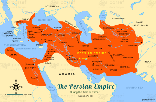
This stock image is a map of the Persian Empire during the reign of King Xerxes I, also known as Ahasuerus, in the 5th century BC. The empire is depicted as a vast expanse covering much of modern-day Iran, Iraq, and parts of Central Asia, including present-day Afghanistan and parts of Pakistan. The image shows the location of the capital city of Susa, where the events of the biblical book of Esther take place.
The empire is also divided into satrapies, or provinces, each ruled by a satrap, who in turn was accountable to the king.
This map highlights the significant influence and power of the Persian Empire during this time period, and its far-reaching territorial expansion.

