Printable Israel in the Time of Jesus
$20.00
- Description
Description
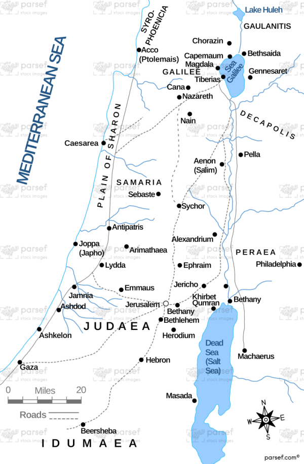
The stock image depicts the geographic area where Jesus lived and carried out his ministry.
The map shows the major cities and towns, including Jerusalem, Bethlehem, Nazareth, and Capernaum, as well as the major bodies of water, such as the Sea of Galilee and the Dead Sea.
The map also shows the major regions, including Judea, Samaria, and Galilee, and the major routes that Jesus may have taken on his travels, such as the Via Dolorosa, the road that Jesus is believed to have taken to his crucifixion.
The map is designed to provide a visual representation of the geography of the region during the time of Jesus and to aid in understanding the context in which the events of the New Testament took place.

