Territory of Ancient of Israel
17,00 €
- Description
Description
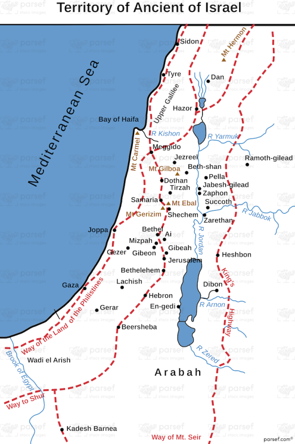
The stock image displays the territory of ancient Israel, encompassing the regions that were occupied by the Israelites during biblical times. The map includes the coastal plain along the Mediterranean Sea, stretching from the Gaza Strip to the Carmel Mountain range, the central hill country, including the region around Jerusalem, and the Jordan River valley.
The map also shows the borders of neighboring kingdoms, such as Philistia, Moab, Edom, and Ammon, which often conflicted with Israel. The cities of Samaria, Bethlehem, Jericho, and many others are marked on the map, along with key bodies of water such as the Sea of Galilee, the Dead Sea, and the Jordan River.
This map provides a visual representation of the territorial extent of ancient Israel and its place in the larger context of the ancient Near East.


