The World During the 6th Century BC
17,00 €
- Description
Description
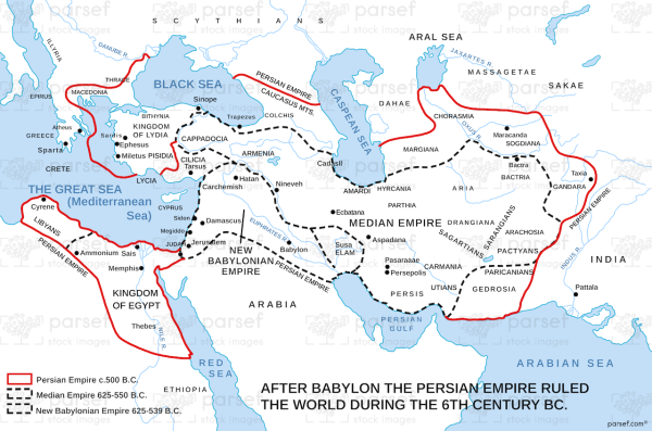
The stock image depicts the major empires, kingdoms, and civilizations of that time period. The map includes the Persian Empire, which was the largest empire of the time, covering parts of modern-day Iran, Iraq, and Central Asia. It also shows the Neo-Babylonian Empire, which was centered in Mesopotamia, as well as the Kingdom of Lydia in present-day Turkey.
The map also includes the Greek city-states, including Athens and Sparta, as well as the kingdoms of Egypt and Kush in Africa. The Achaemenid Empire, founded by Cyrus the Great, had just begun its expansion in the 6th century BC and is also shown on the map.
Overall, this stock image map provides a visual representation of the political landscape of the world during the 6th century BC, a time of great change and expansion of empires and civilizations.


