Upper Galilee
17,00 €
- Description
Description
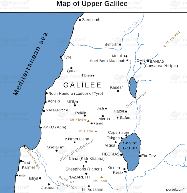
The stock image depicts the northernmost region of ancient Israel during the biblical era. The map shows the terrain of Upper Galilee, which is characterized by high mountains, deep valleys, and lush forests. The area is bordered by the Mediterranean Sea to the west, the Hula Valley to the south, and the Lebanon Mountains to the north.
The map shows the locations of several significant cities in the region, including Hazor, which was the largest city in the area and a major Canaanite stronghold. Other notable cities include Dan, which was the northernmost city in ancient Israel and served as one of the locations of the Israelite tribe of Dan; Kadesh Naphtali, which was an important city during the reign of King Solomon; and Abel Beth Maacah, which was a prominent city during the time of the judges.
Additionally, the map shows the borders of the Israelite tribe of Naphtali, which occupied much of Upper Galilee. The tribe was one of the ten northern tribes of Israel and played a significant role in the region’s history. Overall, the stock image map of Upper Galilee in biblical times provides a glimpse into the landscape and geography of one of the most important regions in ancient Israel.

