Judah at the Time of Haggai
$20.00
- Description
Description
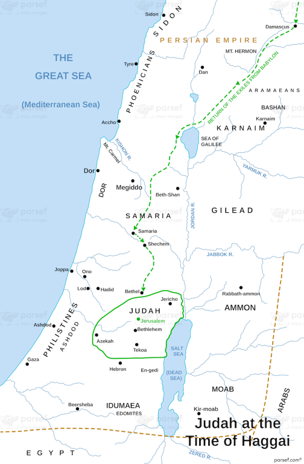
The map depicts the territory of Judah during the 6th century BC, after the Babylonian exile and the return of the Jews to their homeland. The map shows the major cities, towns, and villages of the region, as well as the boundaries of the different provinces and the location of important landmarks.
The map is centered on the city of Jerusalem, which is marked by a red dot. Jerusalem was the capital of Judah and the site of the Temple, which had been destroyed by the Babylonians but was being rebuilt at the time of Haggai. Other important cities in Judah include Hebron, Bethlehem, Jericho, and Beersheba, which are marked by blue dots.
The map also shows the boundaries of the provinces of Judah, including the coastal plain, the foothills, the Judean hills, and the Negev desert. These boundaries are marked by red lines on the map. The Jordan River is shown on the eastern border of Judah, and the Dead Sea is depicted in the southeast corner of the map.
Overall, the map provides a visual representation of the territory of Judah during the time of Haggai and the rebuilding of the Temple. It helps to contextualize the messages of Haggai and provides insight into the geography of the region during this important period of Jewish history.


