Matthew Divisions of Herods Kingdom
18,00 €
- Description
Description
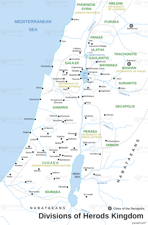
The map shows the divisions of the Kingdom of Herod the Great during the time of Jesus. The Kingdom of Herod the Great was a client state of the Roman Empire in the region of Judea, and Herod was appointed by the Roman Senate as the King of Judea in 37 BCE.
The map displays the three main regions of the kingdom: Judea, Galilee, and Perea. Judea was the southernmost region of the kingdom and included the city of Jerusalem, the Temple, and the surrounding areas. Galilee was a northern region that included the cities of Nazareth and Capernaum, and it was the primary location of Jesus’ early ministry. Perea was located on the eastern side of the Jordan River and was ruled by Herod Antipas, the son of Herod the Great. The map also shows the territories of the neighboring kingdoms of Syria and Arabia, as well as the Roman provinces of Syria and Egypt.
The divisions of the Kingdom of Herod the Great changed over time due to political upheaval, military conquests, and shifts in power within the Roman Empire.


