Paul’s 1st Missionary Journey
17,00 €
- Description
Description
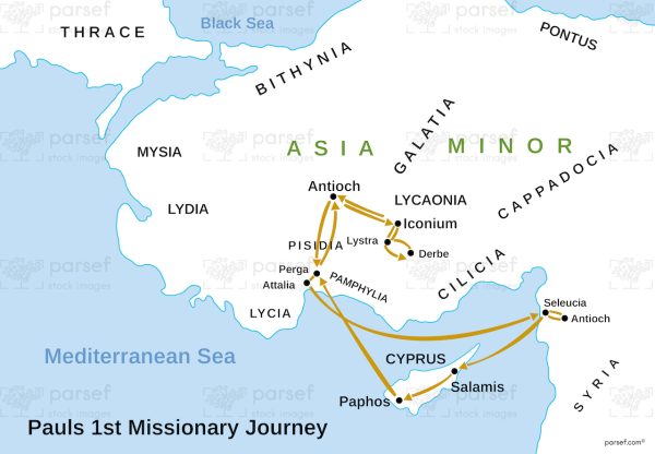
The stock image displays the route that the Apostle Paul took during his first missionary journey in the early days of Christianity. The map highlights the cities that Paul visited, the stops he made along the way, and the distances he traveled.
The journey began in Antioch, Syria, and took him through the island of Cyprus, where he preached in Salamis and Paphos. From there, he sailed to the southern coast of Asia Minor, where he visited cities like Pisidian Antioch, Iconium, Lystra, and Derbe, preaching the gospel and establishing churches.
The map also shows the path Paul took to return to Antioch, Syria, where he reported on the success of his journey to the other apostles. The journey covers a distance of approximately 1,400 miles and is marked by important events such as the stoning of Paul in Lystra and the conversion of Sergius Paulus, the proconsul of Cyprus.


