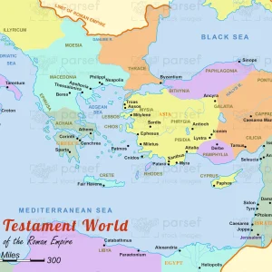
Provinces of the Roman Empire
18,00 €
- Description
Description
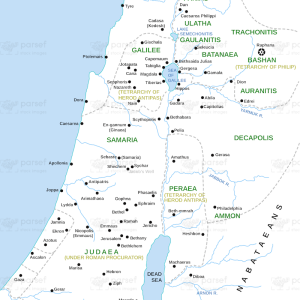
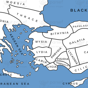
The stock image shows the vast extent of the Roman Empire at its height, during the 2nd century CE. The map is designed with intricate details and colors that depict the provinces of the Roman Empire, as well as the various territories and cities that were under Roman rule.
The map highlights the various regions of the Roman Empire, including the provinces of Africa, Asia, Europe, and Britannia. It also shows the location of important cities such as Rome, Constantinople, Athens, Alexandria, and Jerusalem, which were significant centers of political, economic, and cultural activity.
Furthermore, the map provides information on the important historical events and campaigns that took place during the Roman period. This includes the conquests of Julius Caesar and Augustus, which expanded the Roman Empire to its greatest extent, as well as the establishment of the Pax Romana, a period of relative peace and stability throughout the Empire.
Overall, the stock image provides a useful tool for those interested in studying the history and culture of the ancient world. It highlights the significant achievements of the Roman civilization, which included the development of a sophisticated legal system, the construction of impressive public works such as aqueducts and roads, and the spread of Roman culture and language throughout the Empire.